A New China
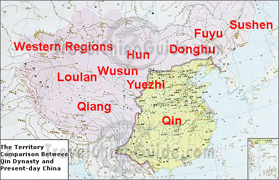
The Qin Dynasty (221 B.C. - 207 B.C.) borders were much different than the borders of the warring states, as you can see in the two maps below. During the warring states, there were many borders since China was split up into many different territories. When Qin Shi Huang became emperor, he conquered all of the different territories combining them into one big unified country. He didn’t just conquer all of the different territories. He also conquered a lot of the land around the territories, as you can see in the two maps below. The Qin dynasty borders were not even half the size of present-day China’s borders. The Qin Dynasty made up most of the east part of present-day China. There were many rivers throughout the land of the Qin Dynasty, such as the Yellow River, the Yangtze River, and more. The capital of the Qin Dynasty was Xianyang. Xianyang was the centre of politics, economy, and culture of the Qin empire. The Qin Dynasty was a very powerful and successful dynasty. A lot was accomplished at that time.
| Map of Warring States |
 |
| Map of Qin Dynasy compared to present-day China |
No comments:
Post a Comment